GLIDER – Unmanned exploration
Maritime Robotics will, as a part of the pioneering GLIDER project, integrate and operate their Wave Glider platform in the Lofoten area this autumn.

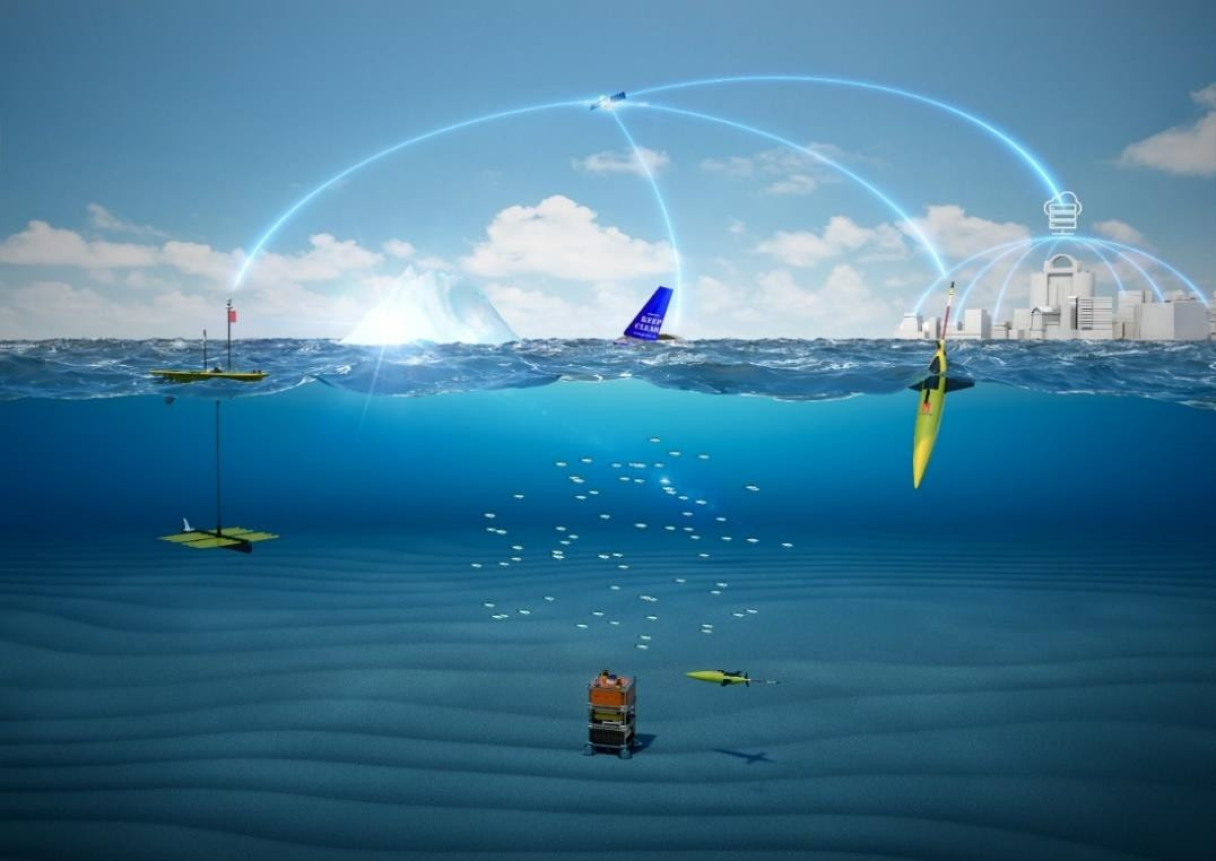
Unmanned ocean vehicles collect field data and send it via satellite on shore. From left: Wave Glider, Sailbuoy and Seaglider™. (3D visualization by courtesy of Kongsberg Maritime AS).
The Glider project – unmanned ocean environmental monitoring
The Wave Glider will be joined by the Sailbuoy from Offshore Sensing and the Seaglider from Kongsberg Maritime. Equipped with biomass-echosounders, hydrophones, CDT, fluorometers an other chemical detection sensors, the fleet of 3 ocean robots will gather important information about the ocean environment.
The project is managed by Akvaplan-niva AS and funded by ConocoPhillips Skandinavia AS and the Norwegian Research Council. The research and innovation partners are Met, the Norwegian Institute of Water Research, UiT- The Arctic University of Norway, Nord University, Kongsberg Maritime AS, SIMRAD, Maritime Robotics AS, Offshore Sensing AS, Christian Michelsen Research AS and Aanderaa Data Instruments AS.